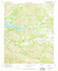
1967 Map of Santa Margarita Lake
USGS Topo · Published 1969About this map
Santa Margarita Lake dominates the central terrain of this 1960s survey, its branching waters controlled by a Spillway and surrounded by numerous Picnic Areas and a Boat Ramp. The landscape is defined by the sharp transition from the lake’s recreation areas to the industrial and agricultural history of the Los Padres National Forest. Mining heritage is evident at the Rinconada Mine and Mercury Belle Mine, while small settlements like Pozo and Pippin Corner anchor the eastern road network along Pozo Road.
Find a feature on this map
46 named features on this map. Tap any name to fly to it.
Don’t see what you’re looking for? This feature index may not catch every label — zoom into the map to look around manually.
Map Details
Editions of this 1967 Santa Margarita Lake Map
3 editions found
Other maps of this area

1897 · San Luis Obispo
USGS Topo · 1:62,500

1897 · Arroyo Grande
USGS Topo · 1:62,500

1900 · San Luis
USGS Topo · 1:125,000

1922 · Pozo
USGS Topo · 1:62,500

1922 · Nipomo
USGS Topo · 1:62,500

1942 · San Luis Obispo
USGS Topo · 1:62,500

1942 · Arroyo Grande
USGS Topo · 1:62,500

1947 · San Luis Obispo
USGS Topo · 1:250,000

1948 · San Luis Obispo
USGS Topo · 1:250,000

1952 · Arroyo Grande
USGS Topo · 1:62,500