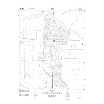
2012 Map of Santa Maria
USGS Topo · Published 2012About this map
The Santa Maria River defines the northern edge of this coastal valley landscape, where urban development meets industrial and agricultural utility. Centered on Santa Maria, the map illustrates a complex network of residential streets and industrial nodes including Midco, Pacer, and Rosemary. The southern reaches are marked by the Santa Maria Airport and the nearby Airbase, reflecting the area's strategic transportation infrastructure.
Find a feature on this map
79 named features on this map. Tap any name to fly to it.
Don’t see what you’re looking for? This feature index may not catch every label — zoom into the map to look around manually.
Map Details
Editions of this 2012 Santa Maria Map
This is the sole edition of this map. No revisions or reprints were ever made.
Other maps of this area

1897 · Arroyo Grande
USGS Topo · 1:62,500

1900 · San Luis
USGS Topo · 1:125,000

1905 · Guadalupe
USGS Topo · 1:125,000

1905 · Lompoc
USGS Topo · 1:125,000

1922 · Nipomo
USGS Topo · 1:62,500

1942 · Guadalupe
USGS Topo · 1:125,000

1942 · Lompoc
USGS Topo · 1:125,000

1942 · Arroyo Grande
USGS Topo · 1:62,500

1942 · Santa Maria
USGS Topo · 1:62,500

1942 · Point Sal
USGS Topo · 1:62,500