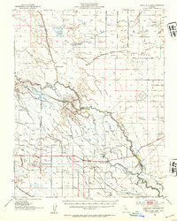
1946 Map of Santa Rita Park
USGS Topo · Published 1954About this map
The complex hydraulic landscape of the San Joaquin Valley is meticulously detailed in this survey, showing a transition from natural slough systems to an intensive network of irrigation and drainage canals. The San Joaquin River meanders through the center of the sheet, flanked by dozens of named waterways including Santa Rita Slough, Pick Anderson Slough, and Shearn Slough. This region, including the curiously named Sandy Mush Country, was defined by its large ranching estates such as Cranes Ranch, McNamara Ranch, and the Belmont Ranch. Small community hubs like Santa Rita Park and the Lone Tree Sch provide points of interest for genealogists tracing family histories in rural Merced and Fresno counties. The southern edge is anchored by the Southern Pacific railroad line near Agatha, marking the vital transport artery for the valley's agricultural output, including operations at Wolfsen Mill.
Find a feature on this map
69 named features on this map. Tap any name to fly to it.
Don’t see what you’re looking for? This feature index may not catch every label — zoom into the map to look around manually.
Map Details
Editions of this 1946 Santa Rita Park Map
This is the sole edition of this map. No revisions or reprints were ever made.
Other maps of this area

1913 · Panoche
USGS Topo · 1:125,000

1914 · Merced
USGS Topo · 1:31,680

1916 · Santa Rita Bridge
USGS Topo · 1:24,000

1916 · Delta Ranch
USGS Topo · 1:24,000

1917 · Merced
USGS Topo · 1:31,680

1918 · Arena
USGS Topo · 1:31,680

1918 · Bliss Ranch
USGS Topo · 1:31,680

1918 · Lingard
USGS Topo · 1:31,680

1918 · Atwater
USGS Topo · 1:31,680

1918 · Stevinson
USGS Topo · 1:31,680