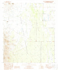
1989 Map of Santa Rosa Mountains NE
USGS Topo · Published 1989About this map
The Papago Indian Reservation dominates this desert landscape, where the rugged topography of the Santa Rosa Mountains meets the wide expanse of the Aguirre Valley. In the late 1980s, this area of Pima County remained largely defined by traditional water management and mineral exploration. Traces of human activity are concentrated around features like the Mine Shaft and various prospects near Stone Peak, as well as an extensive network of irrigation efforts including a Levee, a Ditch, and an abandoned ditch. The natural drainage of the Tat Momoli Wash and Aguirre Wash is managed through several check dams, illustrating the ongoing struggle to control seasonal water flow in the arid Southwest. A series of 4wd trails provides the only access through the desert floor and up toward the Slate Mountains in the northern reaches of the quadrangle.
Find a feature on this map
20 named features on this map. Tap any name to fly to it.
Don’t see what you’re looking for? This feature index may not catch every label — zoom into the map to look around manually.
Map Details
Editions of this 1989 Santa Rosa Mountains NE Map
This is the sole edition of this map. No revisions or reprints were ever made.
Other maps of this area

1934 · Silver Bell
USGS Topo · 1:125,000

1942 · Silver Reef Mountains
USGS Topo · 1:62,500

1947 · Eloy
USGS Topo · 1:62,500

1948 · Eloy
USGS Topo · 1:62,500

1956 · Tucson
USGS Topo · 1:250,000

1958 · Tucson
USGS Topo · 1:250,000

1959 · Tucson
USGS Topo · 1:250,000

1959 · Vaca Hills
USGS Topo · 1:62,500

1962 · Tucson
USGS Topo · 1:250,000
1963 · Santa Rosa Mountains
USGS Topo · 1:62,500