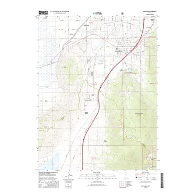
2017 Map of Santaquin
USGS Topo · Published 2017About this map
Santaquin serves as the focal point of this 2017 survey, situated at the junction of the Juab Valley and the southern edge of the Utah Valley. The map captures a landscape defined by significant water management and varied terrain, from the agricultural fields near Genola and Townsend to the high elevations of the Uinta National Forest. The transition between Utah and Juab counties is clearly marked as it passes through the mountain passes of Santaquin Canyon and Pole Canyon.
Find a feature on this map
63 named features on this map. Tap any name to fly to it.
Don’t see what you’re looking for? This feature index may not catch every label — zoom into the map to look around manually.
Map Details
Editions of this 2017 Santaquin Map
This is the sole edition of this map. No revisions or reprints were ever made.
Other maps of this area

1885 · Salt Lake
USGS Topo · 1:250,000

1885 · Manti
USGS Topo · 1:250,000

1895 · Manti
USGS Topo · 1:250,000

1948 · Spanish Fork
USGS Topo · 1:24,000

1949 · Provo
USGS Topo · 1:62,500

1950 · Spanish Fork
USGS Topo · 1:24,000

1950 · West Mountain
USGS Topo · 1:24,000
1950 · Goshen Valley North
USGS Topo · 1:24,000
1950 · West Mountain
USGS Topo · 1:62,500

1951 · Santaquin
USGS Topo · 1:62,500