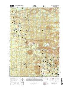
2017 Map of Santiam Junction
USGS Topo · Published 2017About this map
Santiam Junction sits at the nexus of several vital travel corridors within the Willamette National Forest, where the N Santiam River finds its headwaters among numerous volcanic features and alpine basins. The landscape is defined by its dramatic geology, ranging from the prominent cinder cone of Hoodoo Butte to the massive Hogg Rock and the distinct volcanic vents of Nash Crater and Little Nash Crater. The historical Old Santiam Wagon Rd still traces its way across the southern portion of the quadrangle, serving as a reminder of the early pioneer routes that crossed the Cascade Range long before the modern state airport and highway interchange were established. The area is exceptionally dense with high-country water bodies, including the popular Duffy Lake, Santiam Lake, and Big Lake, which dot the wilderness at the base of summits like Sand Mtn and Maxwell Butte.
Find a feature on this map
92 named features on this map. Tap any name to fly to it.
Don’t see what you’re looking for? This feature index may not catch every label — zoom into the map to look around manually.
Map Details
Editions of this 2017 Santiam Junction Map
This is the sole edition of this map. No revisions or reprints were ever made.
Other maps of this area

1927 · Mt. Jefferson
USGS Topo · 1:125,000

1929 · Mill City
USGS Topo · 1:125,000

1929 · Three Sisters
USGS Topo · 1:125,000

1930 · Mt. Jefferson
USGS Topo · 1:125,000

1932 · Three Sisters
USGS Topo · 1:125,000

1934 · Mc Kenzie Bridge
USGS Topo · 1:96,000

1940 · Mc Kenzie Bridge
USGS Topo · 1:125,000

1953 · Salem
USGS Topo · 1:250,000

1954 · Salem
USGS Topo · 1:250,000

1955 · Echo Mountain
USGS Topo · 1:62,500