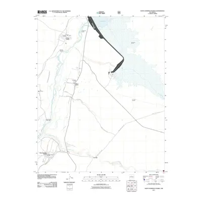
2011 Map of Santo Domingo Pueblo
USGS Topo · Published 2011About this map
The Rio Grande flows through this 2011 landscape, anchoring a series of historic settlements and Pueblo lands. The massive Cochiti Dam structure regulates the northern waters of Cochiti Lake, while downstream the traditional center of Cochiti Pueblo is documented alongside its post office. The map provides significant detail for genealogists and local historians, including the Peña Blanca Cemetery and Sile Cemetery, situated near the agricultural corridors of Peña Blanca and Sile.
Find a feature on this map
34 named features on this map. Tap any name to fly to it.
Don’t see what you’re looking for? This feature index may not catch every label — zoom into the map to look around manually.
Map Details
Editions of this 2011 Santo Domingo Pueblo Map
This is the sole edition of this map. No revisions or reprints were ever made.
Other maps of this area

1892 · San Pedro
USGS Topo · 1:125,000

1892 · Santa Clara
USGS Topo · 1:125,000

1952 · Montoso Peak
USGS Topo · 1:24,000

1953 · Cochiti Dam
USGS Topo · 1:24,000

1953 · Santo Domingo Pueblo
USGS Topo · 1:24,000

1953 · Tetilla Peak
USGS Topo · 1:24,000

1953 · Santo Domingo Pueblo SW
USGS Topo · 1:24,000

1953 · Canada
USGS Topo · 1:24,000

1953 · Agua Fria
USGS Topo · 1:62,500

1953 · Santo Domingo Pueblo
USGS Topo · 1:62,500