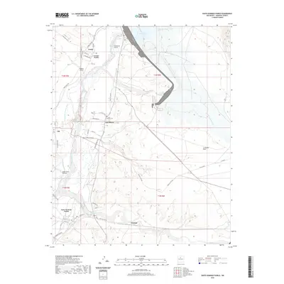
2020 Map of Santo Domingo Pueblo
USGS Topo · Published 2020About this map
Cochiti Dam anchors this high-desert landscape, creating the expansive Cochiti Lake and regulating the flow of the Rio Grande as it passes through Sandoval County. The map documents a deep cultural history, centering on the traditional lands of Cochiti Pueblo and Santo Domingo Pueblo. These sovereign communities are connected by a network of service roads and ancient pathways, such as Pueblo Route 85 and Indian Svc Rte 84, which trace the river valley's fertile corridor. Small settlements like Peña Blanca and Sile are clearly defined, complete with local landmarks such as Peña Blanca Cem and Sile Cem. To the east, the terrain rises sharply toward the volcanic features of La Majada Mesa and Tetilla Peak, showing the dramatic elevation changes that characterize the edge of the La Bajada escarpment near the southern end of the Rio Grande rift.
Find a feature on this map
53 named features on this map. Tap any name to fly to it.
Don’t see what you’re looking for? This feature index may not catch every label — zoom into the map to look around manually.
Map Details
Editions of this 2020 Santo Domingo Pueblo Map
This is the sole edition of this map. No revisions or reprints were ever made.
Other maps of this area

1892 · San Pedro
USGS Topo · 1:125,000

1892 · Santa Clara
USGS Topo · 1:125,000

1952 · Montoso Peak
USGS Topo · 1:24,000

1953 · Cochiti Dam
USGS Topo · 1:24,000

1953 · Santo Domingo Pueblo
USGS Topo · 1:24,000

1953 · Tetilla Peak
USGS Topo · 1:24,000

1953 · Santo Domingo Pueblo SW
USGS Topo · 1:24,000

1953 · Canada
USGS Topo · 1:24,000

1953 · Agua Fria
USGS Topo · 1:62,500

1953 · Santo Domingo Pueblo
USGS Topo · 1:62,500