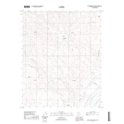
2020 Map of Santo Domingo Pueblo SW
USGS Topo · Published 2020About this map
Santa Ana Mesa dominates the western landscape of this Sandoval County region, where the high desert terrain meets the vital agricultural corridor of the Rio Grande. The intricate water management systems essential to the area's history are clearly mapped, including the Sile Main Canal, Santo Domingo Ditch, and the complex drainage network of the Santo Domingo W Side Drain and Santo Domingo E Side-Riverside Drain. This modern 2020 survey illustrates how local infrastructure follows the natural contours of the land, with Indian Svc Rte 85 and Indian Svc Rte 89 providing access through the varied topography of Borrego Canyon and Peralta Canyon. The arrangement of these roads and canals reflects centuries of adaptation to the arid environment, serving as a primary record of land use and water rights near the Rio Grande.
Find a feature on this map
20 named features on this map. Tap any name to fly to it.
Don’t see what you’re looking for? This feature index may not catch every label — zoom into the map to look around manually.
Map Details
Editions of this 2020 Santo Domingo Pueblo SW Map
This is the sole edition of this map. No revisions or reprints were ever made.
Other maps of this area

1888 · Bernalillo
USGS Topo · 1:125,000

1889 · Albuquerque
USGS Topo · 1:125,000

1890 · Jemes
USGS Topo · 1:125,000

1892 · San Pedro
USGS Topo · 1:125,000

1892 · Jemes
USGS Topo · 1:125,000

1892 · Santa Clara
USGS Topo · 1:125,000

1893 · Albuquerque
USGS Topo · 1:125,000

1943 · Jemez
USGS Topo · 1:62,500

1952 · Jemez
USGS Topo · 1:62,500

1953 · Cochiti Dam
USGS Topo · 1:24,000