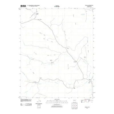
2010 Map of Sapello
USGS Topo · Published 2010About this map
Sapello River and Manuelitas Creek define the geography of this northern New Mexico landscape, where water-carved canyons and high ridges dictate the pattern of human settlement. The rural communities of San Ignacio, Canoncito, and Sapello are positioned along these critical waterways, reflecting a traditional acequia-adjacent lifestyle. The map documents numerous family and community landmarks, including the Sapello Post Office and five distinct burial sites such as Soledad Cemetery and Santa Niño Cemetery, which serve as vital touchstones for local genealogical research.
Find a feature on this map
35 named features on this map. Tap any name to fly to it.
Don’t see what you’re looking for? This feature index may not catch every label — zoom into the map to look around manually.
Map Details
Editions of this 2010 Sapello Map
This is the sole edition of this map. No revisions or reprints were ever made.
Other maps of this area

1889 · Las Vegas
USGS Topo · 1:125,000

1891 · Las Vegas
USGS Topo · 1:125,000

1893 · Las Vegas
USGS Topo · 1:125,000

1954 · Santa Fe
USGS Topo · 1:250,000

1958 · Santa Fe
USGS Topo · 1:250,000

1961 · El Porvenir
USGS Topo · 1:24,000

1961 · Montezuma
USGS Topo · 1:24,000

1963 · Lake Isabel
USGS Topo · 1:24,000

1963 · Rainsville
USGS Topo · 1:24,000
1963 · Las Vegas NW
USGS Topo · 1:24,000