
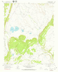
1963 Map of Rainsville
USGS Topo · Published 1965About this map
Rainsville and the surrounding high plains of northern New Mexico are defined by a sophisticated network of surface water management in the early 1960s. This survey illustrates a landscape of intermittent streams and managed reservoirs, where the Mora River and Coyote Creek support a series of named bodies of water including La Cueva Lake, Red Lake, and Baker Lake. The settlement patterns here are deeply tied to these water sources and the terrain, with small communities like Golondrinas and La Cueva serving as local anchors. Genealogical interest is high in this area, with the presence of the Sacred Heart Ch and the Golondrinas Cem providing clear markers of community longevity. Large landholdings, such as the Salman Ranch, contrast with smaller clusters of homes and schools, reflecting the ranching economy and the distinct social geography of Mora County during this period.
Find a feature on this map
23 named features on this map. Tap any name to fly to it.
Don’t see what you’re looking for? This feature index may not catch every label — zoom into the map to look around manually.
Map Details
Editions of this 1963 Rainsville Map
2 editions found
Other maps of this area

1889 · Las Vegas
USGS Topo · 1:125,000

1891 · Las Vegas
USGS Topo · 1:125,000

1893 · Las Vegas
USGS Topo · 1:125,000

1954 · Santa Fe
USGS Topo · 1:250,000

1954 · Raton
USGS Topo · 1:250,000

1958 · Raton
USGS Topo · 1:250,000

1958 · Santa Fe
USGS Topo · 1:250,000

1963 · Lake Isabel
USGS Topo · 1:24,000

1963 · Fort Union
USGS Topo · 1:24,000
1963 · Loma Parda
USGS Topo · 1:24,000