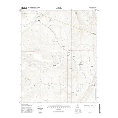
2017 Map of Sapello
USGS Topo · Published 2017About this map
The Sapello River and its numerous tributaries, including Manuelitas Cr and Rito Colorado, carve a complex network of canyons across this Northern New Mexico landscape. Small settlements and ranching hubs such as Canoncito, San Ignacio, and Manuelitas follow the watercourses, reflecting a traditional pattern of high-altitude land use where narrow valleys provide essential passage. This 2017 survey reveals the continued importance of these historical place-names, which are anchored by local landmarks like Santa Niño Cem and San Isidro Cem. From the high northern slopes of Peñasco Blanco to the southern reach of Sanguijuela Arroyo, the map documents a geography defined by its dramatic relief, including Cañon de Medio and the prominent Fragoso Ridge. Local roads such as El Cantor Rd and Martinez Ranch Rd connect these scattered homesteads across the Mora and San Miguel county line.
Find a feature on this map
43 named features on this map. Tap any name to fly to it.
Don’t see what you’re looking for? This feature index may not catch every label — zoom into the map to look around manually.
Map Details
Editions of this 2017 Sapello Map
This is the sole edition of this map. No revisions or reprints were ever made.
Other maps of this area

1889 · Las Vegas
USGS Topo · 1:125,000

1891 · Las Vegas
USGS Topo · 1:125,000

1893 · Las Vegas
USGS Topo · 1:125,000

1954 · Santa Fe
USGS Topo · 1:250,000

1958 · Santa Fe
USGS Topo · 1:250,000

1961 · El Porvenir
USGS Topo · 1:24,000

1961 · Montezuma
USGS Topo · 1:24,000

1963 · Lake Isabel
USGS Topo · 1:24,000

1963 · Rainsville
USGS Topo · 1:24,000
1963 · Las Vegas NW
USGS Topo · 1:24,000