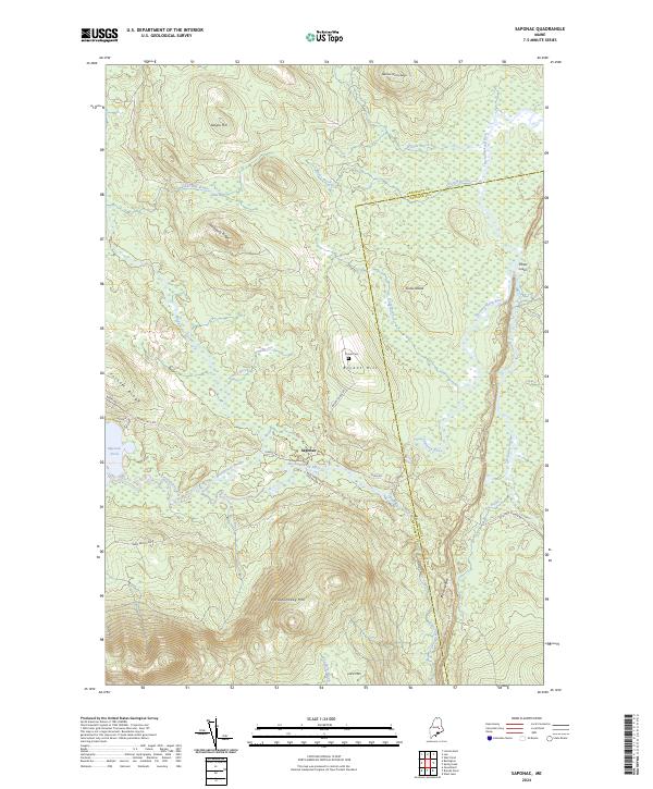
2024 Map of Saponac
USGS Topo · Published 2024About this map
Saponac lies at the heart of this landscape where the Passadumkeag River winds through a vast network of wetlands and drainages. The area is defined by its water-rich topography, from the broad expanse of Saponac Pond to the many brooks like Bowers Brook and Madagascal Stream that feed the river system. Elevations rise sharply at Passadumkeag Mtn and Lord Mtn in the south, contrasting with the low-lying Grass Island and the marshy stretches of Oaks Bog further north. This 2024 survey captures the persistence of the rural landscape, marked by family-named features like Bryant Hill and the Turner Cem along Bryant Ridge Rd. A distinctive glacial feature known as The Horseback runs north-south near the Penobscot and Hancock County line, tracing a path through the wilderness east of Grand Falls.
Find a feature on this map
39 named features on this map. Tap any name to fly to it.
Don’t see what you’re looking for? This feature index may not catch every label — zoom into the map to look around manually.
Map Details
Editions of this 2024 Saponac Map
This is the sole edition of this map. No revisions or reprints were ever made.
Other maps of this area

1920 · Winn
USGS Topo · 1:62,500

1931 · Springfield
USGS Topo · 1:48,000

1931 · Saponac
USGS Topo · 1:48,000

1932 · Nicatous Lake
USGS Topo · 1:48,000

1934 · Saponac
USGS Topo · 1:62,500

1934 · Nicatous Lake
USGS Topo · 1:62,500

1934 · Springfield
USGS Topo · 1:62,500

1954 · Millinocket
USGS Topo · 1:250,000

1957 · Saponac
USGS Topo · 1:62,500

1958 · Millinocket
USGS Topo · 1:250,000