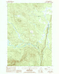
1988 Map of Saponac
USGS Topo · Published 1988About this map
The Passadumkeag River dictates the landscape of this interior Penobscot County region, flowing through a series of dramatic bends and wetlands before reaching Saponac Pond. The small settlement of Saponac serves as a primary point of reference near the river's path, where a local Cem and Gravel Pit are recorded. This topography is defined by prominent elevations such as Grand Falls Mountain and Passadumkeag Mountain, which separate the various brook systems including Madagascal Stream and Pistol Stream. The network of 4WD trails and forest roads indicates an era of active timber management and remote access in the late 1980s. Natural features like Grass Island and Grand Falls illustrate the complex hydrology of the river corridor, while ridges like Folsom Ridge and Hathaway Ridge provide high ground above the extensive bogs.
Find a feature on this map
35 named features on this map. Tap any name to fly to it.
Don’t see what you’re looking for? This feature index may not catch every label — zoom into the map to look around manually.
Map Details
Editions of this 1988 Saponac Map
This is the sole edition of this map. No revisions or reprints were ever made.
Other maps of this area

1920 · Winn
USGS Topo · 1:62,500

1931 · Springfield
USGS Topo · 1:48,000

1931 · Saponac
USGS Topo · 1:48,000

1932 · Nicatous Lake
USGS Topo · 1:48,000

1934 · Saponac
USGS Topo · 1:62,500

1934 · Nicatous Lake
USGS Topo · 1:62,500

1934 · Springfield
USGS Topo · 1:62,500

1954 · Millinocket
USGS Topo · 1:250,000

1957 · Saponac
USGS Topo · 1:62,500

1958 · Millinocket
USGS Topo · 1:250,000