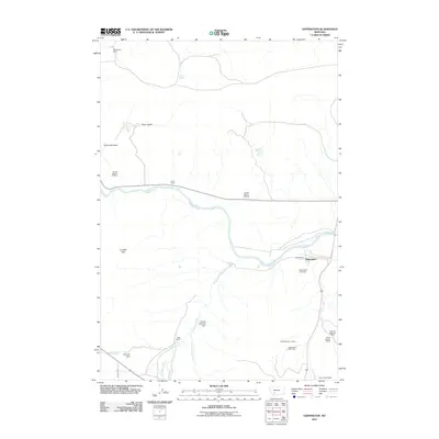
2011 Map of Sappington
USGS Topo · Published 2011About this map
The Jefferson River winds through this landscape, defining the corridor for the settlement of Sappington and its surrounding agricultural and mining interests. This 2011 survey reveals a landscape where ranching and resource extraction coexist, with properties such as Woodward Ranch, Lamb Ranch, and Clark Ranch anchoring the rural economy. Significant mineral exploration is evident in the southeastern corner, where the Sappington Mica Mine, Harrison Highway Mine, and the Sand Creek Shafts reflect a history of industrial activity along the drainage of Sand Creek. The terrain is marked by prominent landmarks like Dolomite Knob and the London Hills, while water management is highlighted by structures such as Hemund Dam and the George Hemund Dam. Genealogists will find the Sappington Cemetery a key local landmark, situated just south of the main settlement near the river's bend.
Find a feature on this map
26 named features on this map. Tap any name to fly to it.
Don’t see what you’re looking for? This feature index may not catch every label — zoom into the map to look around manually.
Map Details
Editions of this 2011 Sappington Map
This is the sole edition of this map. No revisions or reprints were ever made.
Other maps of this area

1888 · Three Forks
USGS Topo · 1:250,000

1894 · Three Forks
USGS Topo · 1:250,000

1895 · Three Forks
USGS Topo · 1:250,000

1947 · Bozeman
USGS Topo · 1:250,000

1948 · Bozeman
USGS Topo · 1:250,000

1949 · Norris
USGS Topo · 1:62,500

1950 · Three Forks
USGS Topo · 1:62,500

1950 · Jefferson Island
USGS Topo · 1:62,500

1950 · Harrison
USGS Topo · 1:62,500

1951 · Norris
USGS Topo · 1:62,500