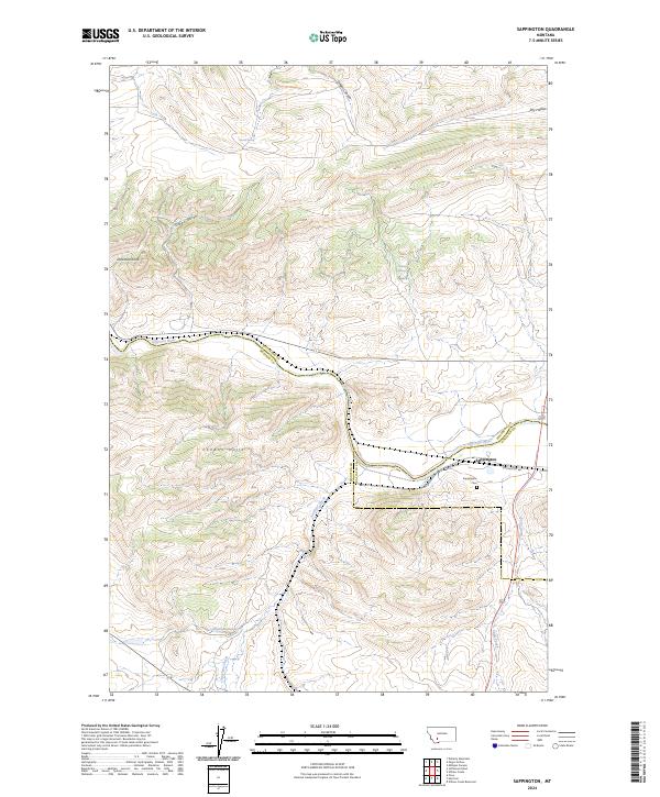
2024 Map of Sappington
USGS Topo · Published 2024About this map
The Jefferson River winds through this landscape, marking the intersection of Jefferson, Madison, and Gallatin Counties. At the heart of this river valley lies Sappington, a small settlement positioned near the junction of Sappington Rd and several critical waterways. To the south, the Sappington Cem serves as a vital anchor for local genealogical research, while the surrounding terrain is defined by prominent elevations such as Dolomite Knob and the London Hills. The mapping of features like Dogtown Sewer and various drainage routes including Antelope Creek and Sand Creek illustrates the complex hydraulic and topographic character of the region. This area, where gulches like Greer Gulch meet the broad river valley, reflects a landscape shaped by both natural water sources like Round Spring and human infrastructure.
Find a feature on this map
22 named features on this map. Tap any name to fly to it.
Don’t see what you’re looking for? This feature index may not catch every label — zoom into the map to look around manually.
Map Details
Editions of this 2024 Sappington Map
This is the sole edition of this map. No revisions or reprints were ever made.
Other maps of this area

1888 · Three Forks
USGS Topo · 1:250,000

1894 · Three Forks
USGS Topo · 1:250,000

1895 · Three Forks
USGS Topo · 1:250,000

1947 · Bozeman
USGS Topo · 1:250,000

1948 · Bozeman
USGS Topo · 1:250,000

1949 · Norris
USGS Topo · 1:62,500

1950 · Three Forks
USGS Topo · 1:62,500

1950 · Jefferson Island
USGS Topo · 1:62,500

1950 · Harrison
USGS Topo · 1:62,500

1951 · Norris
USGS Topo · 1:62,500