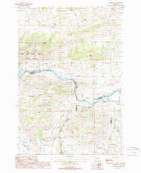
1987 Map of Sappington
USGS Topo · Published 1988About this map
The Jefferson River meanders through a complex geological landscape where Jefferson, Madison, and Gallatin counties converge. In the late 1980s, this area was defined by the industrial presence of the Burlington Northern railroad, which follows the river's path past the small settlement of Sappington. To the northwest, the prominent Lewis and Clark Cavern State Park marks a transition into the elevated London Hills, while the surrounding terrain is etched with evidence of small-scale extraction, including several Prospects and Mines Shafts Prospects. The map captures a high-desert environment where water sources like Huller Springs and Round Spring were critical landmarks. Notable for its surveying of jurisdictional boundaries, the sheet shows the exact triple-county junction southeast of the main river bend, providing a detailed look at the rural infrastructure of Summit Valley and the drainage patterns of Little Antelope Creek.
Find a feature on this map
22 named features on this map. Tap any name to fly to it.
Don’t see what you’re looking for? This feature index may not catch every label — zoom into the map to look around manually.
Map Details
Editions of this 1987 Sappington Map
This is the sole edition of this map. No revisions or reprints were ever made.
Other maps of this area

1888 · Three Forks
USGS Topo · 1:250,000

1894 · Three Forks
USGS Topo · 1:250,000

1895 · Three Forks
USGS Topo · 1:250,000

1947 · Bozeman
USGS Topo · 1:250,000

1948 · Bozeman
USGS Topo · 1:250,000

1949 · Norris
USGS Topo · 1:62,500

1950 · Three Forks
USGS Topo · 1:62,500

1950 · Jefferson Island
USGS Topo · 1:62,500

1950 · Harrison
USGS Topo · 1:62,500

1951 · Norris
USGS Topo · 1:62,500