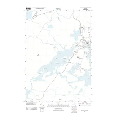
2013 Map of Saranac Lake
USGS Topo · Published 2013About this map
Saranac Lake and its surrounding water network are the focus of this 2013 topographic survey, illustrating a landscape defined by glacial lakes and Adirondack peaks. The village is densely detailed with street names like Algonquin Ave and Petrova Ave, extending toward the shores of Lake Flower. To the west, the interconnected waters of Lower Saranac Lake are dotted with named landforms such as Eagle Island, Green Island, and Sable Island, reflecting the area's long-standing character as a recreational and wilderness hub. Higher elevations are marked by Mount Pisgah, which includes the Mount Pisgah Ski Area, and Dewey Mountain. Local heritage is anchored by sites like Saint Bernards Cem and the small settlement at McMasters Crossing, while the Saranac River and Oseetah Lake trace the lower elevations of this complex hydrologic system.
Find a feature on this map
96 named features on this map. Tap any name to fly to it.
Don’t see what you’re looking for? This feature index may not catch every label — zoom into the map to look around manually.
Map Details
Editions of this 2013 Saranac Lake Map
This is the sole edition of this map. No revisions or reprints were ever made.
Other maps of this area

1902 · Saranac
USGS Topo · 1:62,500

1904 · Saranac
USGS Topo · 1:62,500

1904 · Santanoni
USGS Topo · 1:62,500

1904 · Long Lake
USGS Topo · 1:62,500

1905 · Saint Regis
USGS Topo · 1:62,500

1948 · Ogdensburg
USGS Topo · 1:250,000

1951 · Ogdensburg
USGS Topo · 1:250,000

1953 · Ogdensburg
USGS Topo · 1:250,000

1953 · Santanoni
USGS Topo · 1:62,500

1955 · Long Lake
USGS Topo · 1:62,500