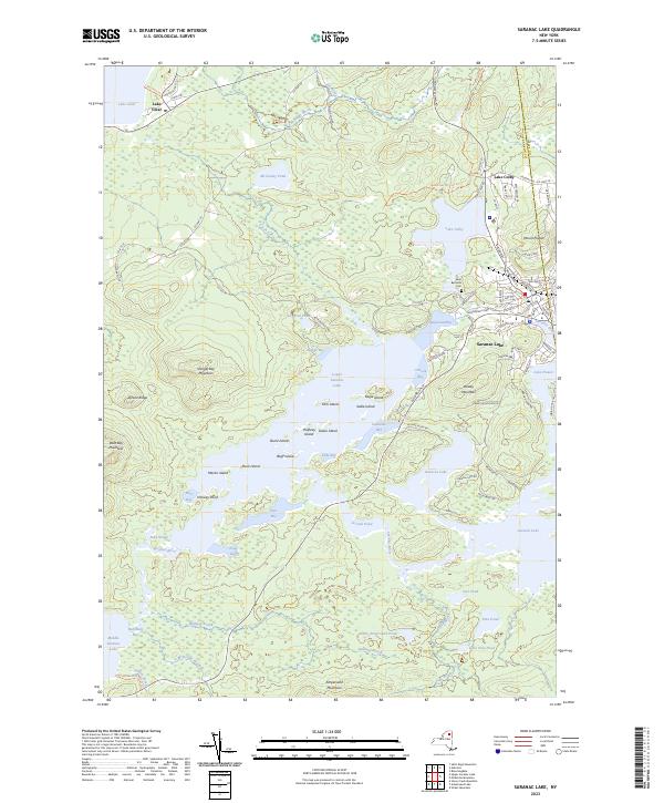
2023 Map of Saranac Lake
USGS Topo · Published 2023About this map
Saranac Lake sits at the heart of this landscape, where the Saranac River connects Lower Saranac Lake to Lake Flower. This modern survey documents the intricate network of water and topography within the Adirondack Park, showing how local infrastructure like Broadway and Ampersand Ave navigates the complex shoreline of Ampersand Bay. The settlement pattern is defined by these waterways, with the village core situated between Lake Colby and the river's edge.
Find a feature on this map
99 named features on this map. Tap any name to fly to it.
Don’t see what you’re looking for? This feature index may not catch every label — zoom into the map to look around manually.
Map Details
Editions of this 2023 Saranac Lake Map
This is the sole edition of this map. No revisions or reprints were ever made.
Other maps of this area

1902 · Saranac
USGS Topo · 1:62,500

1904 · Saranac
USGS Topo · 1:62,500

1904 · Santanoni
USGS Topo · 1:62,500

1904 · Long Lake
USGS Topo · 1:62,500

1905 · Saint Regis
USGS Topo · 1:62,500

1948 · Ogdensburg
USGS Topo · 1:250,000

1951 · Ogdensburg
USGS Topo · 1:250,000

1953 · Ogdensburg
USGS Topo · 1:250,000

1953 · Santanoni
USGS Topo · 1:62,500

1955 · Long Lake
USGS Topo · 1:62,500