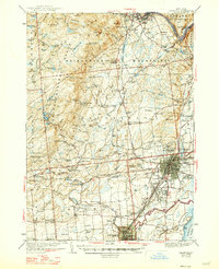
1942 Map of Saratoga
USGS Topo · Published 1947About this map
Ballston Spa and the City of Saratoga Springs serve as the primary hubs in this mid-century survey of Saratoga County. The map details a landscape transitioning from the industrial corridor of the Hudson River to the southern reaches of the Adirondack Mountains. Cultural and educational landmarks like Skidmore College, St Clements College, and the noted estate of Yaddo are clearly delineated.
Find a feature on this map
149 named features on this map. Tap any name to fly to it.
Don’t see what you’re looking for? This feature index may not catch every label — zoom into the map to look around manually.
Map Details
Editions of this 1942 Saratoga Map
2 editions found

Other maps of this area

1893 · Cohoes
USGS Topo · 1:62,500

1893 · Schenectady
USGS Topo · 1:62,500

1895 · Cohoes
USGS Topo · 1:62,500

1895 · Schenectady
USGS Topo · 1:62,500

1895 · Amsterdam
USGS Topo · 1:62,500

1895 · Glens Falls
USGS Topo · 1:62,500

1897 · Glens Falls
USGS Topo · 1:62,500

1898 · Schenectady
USGS Topo · 1:62,500

1898 · Cohoes
USGS Topo · 1:62,500

1899 · Broadalbin
USGS Topo · 1:62,500