
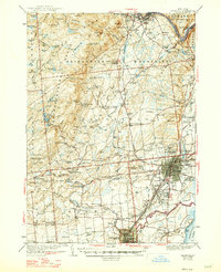
1942 Map of Saratoga
USGS Topo · Published 1942About this map
Skidmore College and the landmark Yaddo estate anchor the eastern edge of this mid-century survey, which reveals the dense urban grid of the City of Saratoga Springs alongside the industrial character of Ballston Spa. To the west, the landscape transitions into the foothills of the Adirondack Mountains, where the Delaware and Hudson railroad winds through timbered terrain toward Corinth. The map documents a network of rural schoolhouses and small family hamlets, such as Porter Corners and Rock City Falls, that supported the local economy before post-war suburbanization. Notable cultural sites are captured here as they stood in the 1930s and early 40s, including St Clements College, the Petrified Gardens, and the Boyhaven Boy Scout Camp near Middle Grove. Natural features like Saratoga Lake and Lake Desolation define the drainage of Kayaderosseras Creek as it flows south toward the paper-mill towns.
Find a feature on this map
125 named features on this map. Tap any name to fly to it.
Don’t see what you’re looking for? This feature index may not catch every label — zoom into the map to look around manually.
Map Details
Editions of this 1942 Saratoga Map
2 editions found
Other maps of this area

1893 · Cohoes
USGS Topo · 1:62,500

1893 · Schenectady
USGS Topo · 1:62,500

1895 · Cohoes
USGS Topo · 1:62,500

1895 · Schenectady
USGS Topo · 1:62,500

1895 · Amsterdam
USGS Topo · 1:62,500

1895 · Glens Falls
USGS Topo · 1:62,500

1897 · Glens Falls
USGS Topo · 1:62,500

1898 · Schenectady
USGS Topo · 1:62,500

1898 · Cohoes
USGS Topo · 1:62,500

1899 · Broadalbin
USGS Topo · 1:62,500