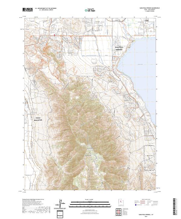
2023 Map of Saratoga Springs
USGS Topo · Published 2023About this map
Utah Lake defines the eastern edge of this modern landscape, where the Jordan River begins its northward flow. This 2023 survey illustrates the rapid urban expansion of Saratoga Springs, Eagle Mountain, and Lehi, contrasting new residential developments with the deep-rooted agricultural infrastructure of the Gardner Canal and Provo Reservoir Canal. The presence of the Glenmar Ranch Airport and the historic route of the Pony Express Pkwy highlight the area's role as a transportation corridor connecting the Cedar Valley to the north end of the lake. To the south, the terrain rises sharply into the Lake Mountains, a complex network of canyons including Mercer Canyon, Losee Canyon, and Wildcat Canyon that remain largely undeveloped, preserving the character of the Great Basin's high desert environment.
Find a feature on this map
120 named features on this map. Tap any name to fly to it.
Don’t see what you’re looking for? This feature index may not catch every label — zoom into the map to look around manually.
Map Details
Editions of this 2023 Saratoga Springs Map
This is the sole edition of this map. No revisions or reprints were ever made.
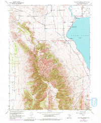
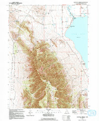
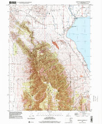
Historical Maps of Saratoga Resort Through Time
4 maps found