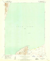
1950 Map of Lincoln Point
USGS Topo · Published 1958About this map
Utah Lake dominates this 1950 survey, which captures the southern shoreline and surrounding topography at a recorded elevation of 4487 feet. The landscape is characterized by the prominent rise of West Mountain, where contour lines trace the steep ascent from the water's edge to various benchmarked heights. Along the southwestern slopes of this ridge, an Abandoned Canal provides evidence of earlier attempts to manage water and irrigation in the region. Near the southern shore, Lincoln Point extends into the lake, while the isolated Bird Island sits nearly centered within the water body. To the east of the point, the drainage of Benjamin Slough meets the shoreline, while the northwestern corner of the quadrangle shows the indentation of Little Cove. This survey reflects a mid-century period when rural infrastructure and physical geography defined the boundaries of the Utah Valley.
Find a feature on this map
13 named features on this map. Tap any name to fly to it.
Don’t see what you’re looking for? This feature index may not catch every label — zoom into the map to look around manually.
Map Details
Editions of this 1950 Lincoln Point Map
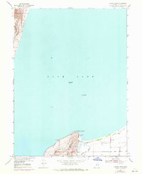
2 editions found
Other maps of this area

1885 · Salt Lake
USGS Topo · 1:250,000

1948 · Spanish Fork
USGS Topo · 1:24,000

1948 · Orem
USGS Topo · 1:24,000

1948 · Orem
USGS Topo · 1:62,500

1948 · Provo
USGS Topo · 1:24,000

1949 · Provo
USGS Topo · 1:62,500

1950 · Orem
USGS Topo · 1:24,000

1950 · Provo
USGS Topo · 1:24,000

1950 · Spanish Fork
USGS Topo · 1:24,000

1950 · West Mountain
USGS Topo · 1:24,000