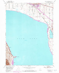
1950 Map of Pelican Point
USGS Topo · Published 1978About this map
Utah Lake dominates this mid-century landscape, framing the industrial and agricultural development of the northern valley. The settlement of American Fork occupies the upper reaches of the sheet, where residential growth meets a complex transportation network defined by the Union Pacific and the Denver and Rio Grande Western railroads. Further south, the prominent geographical feature of Pelican Point extends into the water, serving as a focal point for infrastructure including a Pumping Sta and a Calcite Quarry.
Find a feature on this map
17 named features on this map. Tap any name to fly to it.
Don’t see what you’re looking for? This feature index may not catch every label — zoom into the map to look around manually.
Map Details
Editions of this 1950 Pelican Point Map
3 editions found

Other maps of this area

1885 · Salt Lake
USGS Topo · 1:250,000

1948 · Timpanogos Cave
USGS Topo · 1:24,000

1948 · Orem
USGS Topo · 1:24,000

1948 · Orem
USGS Topo · 1:62,500

1948 · Provo
USGS Topo · 1:24,000

1949 · Provo
USGS Topo · 1:62,500

1950 · Orem
USGS Topo · 1:24,000

1950 · Timpanogos Cave
USGS Topo · 1:24,000

1950 · Provo
USGS Topo · 1:24,000
1950 · Soldiers Pass
USGS Topo · 1:24,000