
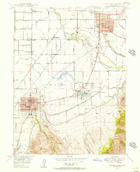
1994 Map of Spanish Fork Peak
USGS Topo · Published 1994About this map
Spanish Fork Peak and the high ridges of the Uinta National Forest dominate this 1994 topographic study of the Wasatch Range transition. The landscape is defined by the steep descent from alpine heights down to the East Bench and the developed corridors of the Utah Valley. Infrastructure for water management is prominent, featuring the Strawberry Highline Canal and the Mapleton Lateral, reflecting the region's historical reliance on engineering to support agriculture and settlement.
Find a feature on this map
59 named features on this map. Tap any name to fly to it.
Don’t see what you’re looking for? This feature index may not catch every label — zoom into the map to look around manually.
Map Details
Editions of this 1994 Spanish Fork Peak Map
This is the sole edition of this map. No revisions or reprints were ever made.
Other maps of this area

1885 · Salt Lake
USGS Topo · 1:250,000

1885 · Manti
USGS Topo · 1:250,000

1895 · Manti
USGS Topo · 1:250,000

1907 · Strawberry Valley
USGS Topo · 1:125,000

1909 · Strawberry Valley
USGS Topo · 1:125,000
1948 · Spanish Fork
USGS Topo · 1:24,000
1948 · Springville
USGS Topo · 1:24,000
1948 · Provo
USGS Topo · 1:24,000

1949 · Provo
USGS Topo · 1:62,500
1949 · Spanish Fork Peak
USGS Topo · 1:24,000