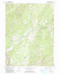
1994 Map of Billies Mtn.
USGS Topo · Published 1994About this map
Billies Mountain and the surrounding drainage basins within the Uinta National Forest define this landscape south of the Strawberry Reservoir region. The confluence of Little Diamond Creek and the Diamond Fork provides a focal point for both natural history and early settlement, marked by the Diamond Battle Historical Monument and a nearby historical marker. The transport network of the era is clearly visible, with the Denver & Rio Grande Western RR following the curves of Spanish Fork Canyon at the southwestern edge of the quadrangle.
Find a feature on this map
38 named features on this map. Tap any name to fly to it.
Don’t see what you’re looking for? This feature index may not catch every label — zoom into the map to look around manually.
Map Details
Editions of this 1994 Billies Mtn. Map
This is the sole edition of this map. No revisions or reprints were ever made.
Other maps of this area

1885 · Salt Lake
USGS Topo · 1:250,000

1885 · Manti
USGS Topo · 1:250,000

1895 · Manti
USGS Topo · 1:250,000

1907 · Strawberry Valley
USGS Topo · 1:125,000

1909 · Strawberry Valley
USGS Topo · 1:125,000

1948 · Springville
USGS Topo · 1:24,000

1949 · Provo
USGS Topo · 1:62,500

1949 · Spanish Fork Peak
USGS Topo · 1:24,000
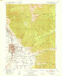
1950 · Springville
USGS Topo · 1:24,000

1951 · Spanish Fork Peak
USGS Topo · 1:24,000