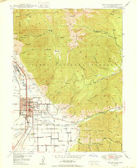
1950 Map of Springville
USGS Topo · Published 1950About this map
Springville and Mapleton are the primary population centers on this mid-century survey, situated at the base of the Wasatch Mountain range. The valley floor shows a grid of agriculture and civic development, featuring a cluster of local schools such as Lincoln Sch and Jefferson Sch, and two cemeteries including Evergreen Cem. Along the western edge, industrial activity is evident near Ironton, where a Slag Dump and multiple Gravel Pits suggest the area's economic reliance on mining and mineral extraction.
Find a feature on this map
78 named features on this map. Tap any name to fly to it.
Don’t see what you’re looking for? This feature index may not catch every label — zoom into the map to look around manually.
Map Details
Editions of this 1950 Springville Map
This is the sole edition of this map. No revisions or reprints were ever made.
Other maps of this area

1885 · Salt Lake
USGS Topo · 1:250,000

1907 · Strawberry Valley
USGS Topo · 1:125,000

1909 · Strawberry Valley
USGS Topo · 1:125,000

1948 · Spanish Fork
USGS Topo · 1:24,000

1948 · Orem
USGS Topo · 1:24,000

1948 · Orem
USGS Topo · 1:62,500

1948 · Springville
USGS Topo · 1:24,000

1948 · Provo
USGS Topo · 1:24,000

1948 · Bridal Veil Falls
USGS Topo · 1:24,000

1949 · Provo
USGS Topo · 1:62,500