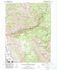
1993 Map of Timpanogos Cave
USGS Topo · Published 1993About this map
Timpanogos Cave National Monument and the surrounding peaks of the Uinta National Forest dominate this 1993 revision, capturing the intersection of subterranean marvels and high-altitude wilderness. The map details the complex terrain of the Timpanogos Wilderness, including Hansen Cave and the dramatic geological features of the Mount Timpanogos massif, such as Pika Cirque and Emerald Lake.
Find a feature on this map
87 named features on this map. Tap any name to fly to it.
Don’t see what you’re looking for? This feature index may not catch every label — zoom into the map to look around manually.
Map Details
Editions of this 1993 Timpanogos Cave Map
2 editions found
Other maps of this area

1885 · Salt Lake
USGS Topo · 1:250,000

1925 · Ft. Douglas
USGS Topo · 1:125,000

1928 · Ft. Douglas
USGS Topo · 1:125,000

1948 · Timpanogos Cave
USGS Topo · 1:24,000

1948 · Orem
USGS Topo · 1:24,000

1948 · Orem
USGS Topo · 1:62,500

1948 · Aspen Grove
USGS Topo · 1:24,000

1948 · Bridal Veil Falls
USGS Topo · 1:24,000

1950 · Orem
USGS Topo · 1:24,000

1950 · Aspen Grove
USGS Topo · 1:24,000