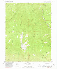
1967 Map of Two Tom Hill
USGS Topo · Published 1978About this map
Uinta National Forest lands dominate this high-country landscape, defined by the deep drainage of the Diamond Fork and its numerous tributary hollows. A significant historical marker, the Indian Treaty Boundary, cuts diagonally across Strawberry Ridge in the northeast, reflecting the complex administrative and tribal history of the region. The map documents the infrastructure of mid-century forest management and recreation, including the Diamond Fork Guard Station and several remote campsites like the Hawthorn Campground. Unique local landmarks such as Mollies Nipple and Two Tom Hill stand out among the peaks. The network of jeep trails and pack trails winding through Wadsworth Creek and Sixth Water Creek illustrates how this backcountry was accessed before modern road development reached deeper into the canyons of Wasatch and Utah counties.
Find a feature on this map
47 named features on this map. Tap any name to fly to it.
Don’t see what you’re looking for? This feature index may not catch every label — zoom into the map to look around manually.
Map Details
Editions of this 1967 Two Tom Hill Map
2 editions found
Other maps of this area

1885 · Salt Lake
USGS Topo · 1:250,000

1907 · Strawberry Valley
USGS Topo · 1:125,000

1909 · Strawberry Valley
USGS Topo · 1:125,000

1954 · Salt Lake City
USGS Topo · 1:250,000

1958 · Salt Lake City
USGS Topo · 1:250,000

1960 · Salt Lake City
USGS Topo · 1:250,000

1966 · Strawberry Reservoir NW
USGS Topo · 1:24,000
1966 · Strawberry Reservoir SW
USGS Topo · 1:24,000

1967 · Two Tom Hill
USGS Topo · 1:24,000
1967 · Granger Mtn
USGS Topo · 1:24,000