
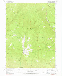
1967 Map of Two Tom Hill
USGS Topo · Published 1969About this map
Uinta National Forest dominates this 1967 survey, where high ridges and deep drainages define the border between Wasatch Co Utah Co. A historical Indian Treaty Boundary slices across the eastern slopes of Strawberry Ridge, marking an earlier era of land division. The terrain is marked by notable peaks such as Two Tom Hill and the uniquely named Mollies Nipple, while the lower elevations follow the complex hydrology of Diamond Fork and its tributaries.
Find a feature on this map
44 named features on this map. Tap any name to fly to it.
Don’t see what you’re looking for? This feature index may not catch every label — zoom into the map to look around manually.
Map Details
Editions of this 1967 Two Tom Hill Map
2 editions found
Other maps of this area

1885 · Salt Lake
USGS Topo · 1:250,000

1907 · Strawberry Valley
USGS Topo · 1:125,000

1909 · Strawberry Valley
USGS Topo · 1:125,000

1954 · Salt Lake City
USGS Topo · 1:250,000

1958 · Salt Lake City
USGS Topo · 1:250,000

1960 · Salt Lake City
USGS Topo · 1:250,000

1966 · Strawberry Reservoir NW
USGS Topo · 1:24,000
1966 · Strawberry Reservoir SW
USGS Topo · 1:24,000
1967 · Granger Mtn
USGS Topo · 1:24,000
1967 · Co-Op Creek
USGS Topo · 1:24,000