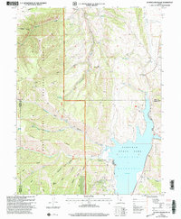
2001 Map of Scofield Reservoir
USGS Topo · Published 2004About this map
Scofield Reservoir and the adjacent Scofield State Park anchor the eastern side of this landscape, situated at the crossroads of Utah, Carbon, and Sanpete counties. The area is dominated by the complex terrain of the Manti-La Sal National Forest, where high ridges like Bear Ridge and Fish Creek Ridge divide numerous steep canyons. The Fish Creek National Recreation Trail follows the course of Fish Creek, providing a primary route through the mountainous interior of the Price Ranger District. The map reveals a land utilized for water management and recreation, evidenced by the presence of a Gaging Station and the distinctive shoreline of the reservoir. Notable family or local place names like Kelly Ridge, Anderson Canyon, and Wife Canyon suggest a history of early ranching or resource use within these high-elevation flats and drainages.
Find a feature on this map
42 named features on this map. Tap any name to fly to it.
Don’t see what you’re looking for? This feature index may not catch every label — zoom into the map to look around manually.
Map Details
Editions of this 2001 Scofield Reservoir Map
This is the sole edition of this map. No revisions or reprints were ever made.
Other maps of this area

1885 · Manti
USGS Topo · 1:250,000

1895 · Manti
USGS Topo · 1:250,000

1923 · Scofield
USGS Topo · 1:62,500

1925 · Scofield
USGS Topo · 1:62,500

1939 · Soldier Summit
USGS Topo · 1:62,500

1942 · Soldier Summit
USGS Topo · 1:62,500

1956 · Price
USGS Topo · 1:250,000

1960 · Price
USGS Topo · 1:250,000

1962 · Price
USGS Topo · 1:250,000

1965 · Fairview Lakes
USGS Topo · 1:24,000