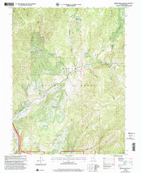
1998 Map of Billies Mountain
USGS Topo · Published 2002About this map
Uinta National Forest lands dominate this late-twentieth-century landscape, centered on the steep drainages of Diamond Fork and the prominent peak of Billies Mountain. The map preserves a quiet human history of the canyon, marked by sites like Patrick Place and Seven Oaks, alongside evidence of the region’s earlier conflicts at the Diamond Battle Historical Monument. This area, managed by the Forest Service, reveals a landscape used for both recreation and utility, featuring the Diamond Campgrounds near Diamond Fork and several monitoring points like the Gaging Station and Gaging Sta. The topography is defined by a dense network of named hollows and canyons, including Wannhodes Canyon, Maple Canyon, and Monks Hollow, illustrating the complex drainage system feeding into the Spanish Fork Canyon.
Find a feature on this map
39 named features on this map. Tap any name to fly to it.
Don’t see what you’re looking for? This feature index may not catch every label — zoom into the map to look around manually.
Map Details
Editions of this 1998 Billies Mountain Map
This is the sole edition of this map. No revisions or reprints were ever made.
Other maps of this area

1885 · Salt Lake
USGS Topo · 1:250,000

1885 · Manti
USGS Topo · 1:250,000

1895 · Manti
USGS Topo · 1:250,000

1907 · Strawberry Valley
USGS Topo · 1:125,000

1909 · Strawberry Valley
USGS Topo · 1:125,000

1948 · Springville
USGS Topo · 1:24,000

1949 · Provo
USGS Topo · 1:62,500

1949 · Spanish Fork Peak
USGS Topo · 1:24,000
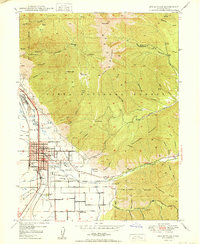
1950 · Springville
USGS Topo · 1:24,000

1951 · Spanish Fork Peak
USGS Topo · 1:24,000