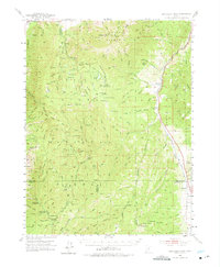
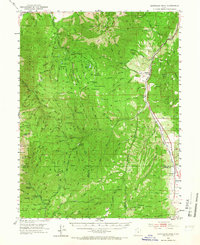
1952 Map of Santaquin Peak
USGS Topo · Published 1975About this map
Santaquin Peak and the high ridges of the Uinta National Forest dominate this early 1950s survey of the central Utah highlands. The landscape is defined by the sharp transition from high-elevation lookouts like Mt Nebo AS to the productive valleys below. Along the eastern edge, the Denver and Rio Grande Western RR tracks follow the Thistle Creek corridor, serving small rail-side settlements such as Birdseye and Indianola. Local industry is evidenced by the Birdseye Quarries, while the growing mid-century interest in outdoor recreation is reflected in the established Nebo Loop Road and sites like Bear Canyon Recreation Area. Isolated outposts like Wimmer Ranch and the Payson Guard Station highlight the land management and ranching patterns of the era. The map also features unique geological landmarks such as Devils Kitchen and numerous high-country water sources including Payson Lakes and Winward Res.
Find a feature on this map
133 named features on this map. Tap any name to fly to it.
Don’t see what you’re looking for? This feature index may not catch every label — zoom into the map to look around manually.
Map Details
Editions of this 1952 Santaquin Peak Map
3 editions found

Other maps of this area

1885 · Salt Lake
USGS Topo · 1:250,000

1885 · Manti
USGS Topo · 1:250,000

1895 · Manti
USGS Topo · 1:250,000

1907 · Strawberry Valley
USGS Topo · 1:125,000

1909 · Strawberry Valley
USGS Topo · 1:125,000

1948 · Spanish Fork
USGS Topo · 1:24,000

1949 · Provo
USGS Topo · 1:62,500

1949 · Spanish Fork Peak
USGS Topo · 1:24,000

1950 · Spanish Fork
USGS Topo · 1:24,000

1950 · West Mountain
USGS Topo · 1:24,000