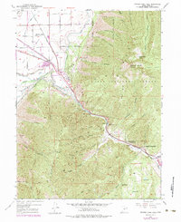
1949 Map of Spanish Fork Peak
USGS Topo · Published 1984About this map
Spanish Fork Pk anchors the rugged landscape of the Uinta National Forest, where the Wasatch Range transitions from high alpine ridges to the industrial and agricultural corridors of the Utah Valley. This survey reveals a complex network of water management and industrial development along the Spanish Fork River, featuring specialized infrastructure like the Siphon, Flume, and a Powerhouse. The presence of the Powder Plant and the Gaging Station near Gomex highlights the era's focus on resource extraction and utility regulation.
Find a feature on this map
61 named features on this map. Tap any name to fly to it.
Don’t see what you’re looking for? This feature index may not catch every label — zoom into the map to look around manually.
Map Details
Editions of this 1949 Spanish Fork Peak Map
4 editions found
Other maps of this area

1885 · Salt Lake
USGS Topo · 1:250,000

1885 · Manti
USGS Topo · 1:250,000

1895 · Manti
USGS Topo · 1:250,000

1907 · Strawberry Valley
USGS Topo · 1:125,000

1909 · Strawberry Valley
USGS Topo · 1:125,000

1948 · Spanish Fork
USGS Topo · 1:24,000

1948 · Springville
USGS Topo · 1:24,000

1948 · Provo
USGS Topo · 1:24,000

1949 · Provo
USGS Topo · 1:62,500

1949 · Spanish Fork Peak
USGS Topo · 1:24,000