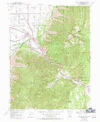
1949 Map of Spanish Fork Peak
USGS Topo · Published 1971About this map
The Wasatch Range landscape meets the industrial activity of the mid-20th century in this topographical study, where the peaks of Loafer Mountain and Spanish Fork Pk overlook a corridor of significant rail and mining infrastructure. The intersection of the Utah Ry and the Denver and Rio Grande Western Railroad defines the transportation hub at Moark Junction, while nearby sites like the Powder Plant and the Siphon indicate the area's utility and manufacturing role. Notable for local history is the Dream Mine located on the slopes of North Bench, along with the Old Spanish Mine and a Quarry near Castilla. The map also captures the complex irrigation system of the valley, featuring the Salem Canal and High Line Canal, alongside the recreational and thermal features of Castilla Springs and Shurtz Lake.
Find a feature on this map
74 named features on this map. Tap any name to fly to it.
Don’t see what you’re looking for? This feature index may not catch every label — zoom into the map to look around manually.
Map Details
Editions of this 1949 Spanish Fork Peak Map
4 editions found
Other maps of this area

1885 · Salt Lake
USGS Topo · 1:250,000

1885 · Manti
USGS Topo · 1:250,000

1895 · Manti
USGS Topo · 1:250,000

1907 · Strawberry Valley
USGS Topo · 1:125,000

1909 · Strawberry Valley
USGS Topo · 1:125,000

1948 · Spanish Fork
USGS Topo · 1:24,000

1948 · Springville
USGS Topo · 1:24,000

1948 · Provo
USGS Topo · 1:24,000

1949 · Provo
USGS Topo · 1:62,500

1949 · Spanish Fork Peak
USGS Topo · 1:24,000