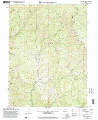
1998 Map of Two Tom Hill
USGS Topo · Published 2000About this map
Uinta National Forest lands dominate this late-1990s topographic survey, revealing a landscape defined by deep drainages and sharp ridgelines. The western edge of the Strawberry Ridge creates a prominent natural boundary between Utah Co and Wasatch Co, also marking the Uinta and Ouray Indian Reservation Boundary. Water management and forestry operations are evident at the Diamond Fork Guard Station and the Springville Crossings, where the Diamond Fork river system meets various tributaries. Named peaks and ridges such as Two Tom Hill, Mollies Nipple, and Timber Mtn provide essential topographic orientation for the area. The map also records localized human activity through features like the Gravel Pit and the Tunnel Road, reflecting the ongoing utility of these canyon lands for transport and resource management at the end of the century.
Find a feature on this map
61 named features on this map. Tap any name to fly to it.
Don’t see what you’re looking for? This feature index may not catch every label — zoom into the map to look around manually.
Map Details
Editions of this 1998 Two Tom Hill Map
This is the sole edition of this map. No revisions or reprints were ever made.
Other maps of this area

1885 · Salt Lake
USGS Topo · 1:250,000

1907 · Strawberry Valley
USGS Topo · 1:125,000

1909 · Strawberry Valley
USGS Topo · 1:125,000

1954 · Salt Lake City
USGS Topo · 1:250,000

1958 · Salt Lake City
USGS Topo · 1:250,000

1960 · Salt Lake City
USGS Topo · 1:250,000

1966 · Strawberry Reservoir NW
USGS Topo · 1:24,000
1966 · Strawberry Reservoir SW
USGS Topo · 1:24,000

1967 · Two Tom Hill
USGS Topo · 1:24,000
1967 · Granger Mtn
USGS Topo · 1:24,000