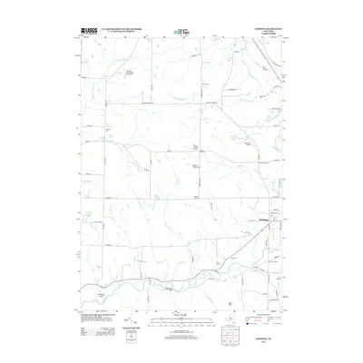
2013 Map of Sardinia
USGS Topo · Published 2013About this map
Cattaraugus Cr defines the southern portion of this region, where the winding waterway is joined by Elton Cr and Stony Cr at The Forks. The landscape is marked by a series of deep ravines, most notably Gunbarrel Gulf and Richmond Gulf, which cut through the terrain south of the main Sardinia settlement. This 2013 survey reveals a distinctive cluster of small aviation facilities, including Knox Landing Airport, Basher Field Airport, and High Acres Airport, suggesting a local tradition of private aeronautics.
Find a feature on this map
78 named features on this map. Tap any name to fly to it.
Don’t see what you’re looking for? This feature index may not catch every label — zoom into the map to look around manually.
Map Details
Editions of this 2013 Sardinia Map
This is the sole edition of this map. No revisions or reprints were ever made.
Other maps of this area

1923 · Arcade
USGS Topo · 1:62,500

1924 · Ellicottville
USGS Topo · 1:62,500

1924 · Franklinville
USGS Topo · 1:62,500

1925 · Springville
USGS Topo · 1:62,500

1925 · Arcade
USGS Topo · 1:62,500

1941 · Ellicottville
USGS Topo · 1:62,500

1942 · Franklinville
USGS Topo · 1:62,500
1954 · Springville
USGS Topo · 1:24,000
1955 · Holland
USGS Topo · 1:24,000
1955 · Colden
USGS Topo · 1:24,000