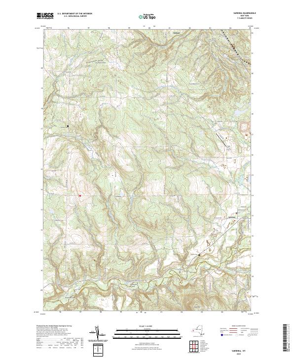
2023 Map of Sardinia
USGS Topo · Published 2023About this map
Cattaraugus Creek carves a deep valley along the border of Erie and Cattaraugus Counties, defining the southern landscape of this Western New York region. This contemporary survey of the rural uplands between Holland and Sardinia shows a territory shaped by glacial geology and a network of named waterways like East Branch Cazenovia Creek and Sprague Brook. Notable geological features include the steep-walled Richmond Gulf and Gunbarrel Gulf, which reflect the erosive power of the local creek systems over centuries. For those studying the community's heritage, the map preserves the locations of Pratham Cem and Quaker Cem, alongside modern aviation sites like Gentzke Aeronautical Park and High Acres Airport. The road network, including the prominent Olean Rd, continues to follow the natural contours of the valley floors and ridges like Blue Hill.
Find a feature on this map
69 named features on this map. Tap any name to fly to it.
Don’t see what you’re looking for? This feature index may not catch every label — zoom into the map to look around manually.
Map Details
Editions of this 2023 Sardinia Map
This is the sole edition of this map. No revisions or reprints were ever made.
Other maps of this area

1923 · Arcade
USGS Topo · 1:62,500

1924 · Ellicottville
USGS Topo · 1:62,500

1924 · Franklinville
USGS Topo · 1:62,500

1925 · Springville
USGS Topo · 1:62,500

1925 · Arcade
USGS Topo · 1:62,500

1941 · Ellicottville
USGS Topo · 1:62,500

1942 · Franklinville
USGS Topo · 1:62,500
1954 · Springville
USGS Topo · 1:24,000
1955 · Holland
USGS Topo · 1:24,000
1955 · Colden
USGS Topo · 1:24,000