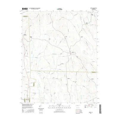
2016 Map of Sardis
USGS Topo · Published 2016About this map
Sardis and Saltillo anchor this Tennessee landscape, where the borders of Henderson, Chester, Hardin, and McNairy Counties converge. The terrain is defined by a series of north-south drainage networks and artificial water management projects, most notably the Middleton Cr Canal and Hurricane Cr Canal. These alterations reflect long-standing efforts to manage the low-lying bottomlands surrounding Claiborne Wells Lake and various creeks. For the local historian, the map preserves the precise locations of numerous community hubs, including the upland settlement at Scotts Hill and the smaller enclave at Hinkle. The distribution of family and community burial grounds, such as Little Hurricane Cem, McBride Cem, and Old Salem Cem, provides a detailed record of the area's rural social geography. The presence of features like Presley Ridge and Hickory Flats illustrates the varied topography between the river valleys.
Find a feature on this map
106 named features on this map. Tap any name to fly to it.
Don’t see what you’re looking for? This feature index may not catch every label — zoom into the map to look around manually.
Map Details
Editions of this 2016 Sardis Map
This is the sole edition of this map. No revisions or reprints were ever made.
Other maps of this area

1936 · Hookers Bend
USGS Topo · 1:24,000

1936 · Scotts Hill
USGS Topo · 1:24,000

1936 · Leapwood
USGS Topo · 1:24,000

1936 · Thurman
USGS Topo · 1:24,000

1936 · Sardis
USGS Topo · 1:24,000

1936 · Reagan
USGS Topo · 1:24,000

1936 · Milledgeville
USGS Topo · 1:24,000

1936 · Enville
USGS Topo · 1:24,000

1936 · Life
USGS Topo · 1:24,000

1949 · Hookers Bend
USGS Topo · 1:24,000