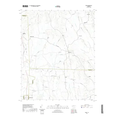
2019 Map of Sardis
USGS Topo · Published 2019About this map
Sardis sits at a focal point of West Tennessee roads, where the boundaries of Henderson, Hardin, and Chester counties converge. This landscape is defined by its agrarian roots and family burial grounds, such as McBride Cem and Spring Hill Cem, which are scattered throughout the countryside. The presence of the Hurricane Cr Canal and various branches like Dry Cr and Flats Cr suggests a history of managed drainage to support local farming.
Find a feature on this map
69 named features on this map. Tap any name to fly to it.
Don’t see what you’re looking for? This feature index may not catch every label — zoom into the map to look around manually.
Map Details
Editions of this 2019 Sardis Map
This is the sole edition of this map. No revisions or reprints were ever made.
Other maps of this area

1936 · Hookers Bend
USGS Topo · 1:24,000

1936 · Scotts Hill
USGS Topo · 1:24,000

1936 · Leapwood
USGS Topo · 1:24,000

1936 · Thurman
USGS Topo · 1:24,000

1936 · Sardis
USGS Topo · 1:24,000

1936 · Reagan
USGS Topo · 1:24,000

1936 · Milledgeville
USGS Topo · 1:24,000

1936 · Enville
USGS Topo · 1:24,000

1936 · Life
USGS Topo · 1:24,000

1949 · Hookers Bend
USGS Topo · 1:24,000