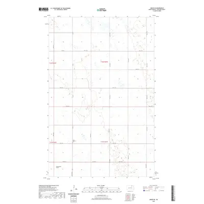
2020 Map of Sarles SE
USGS Topo · Published 2020About this map
Salem Evangelical Cem sits at a crossroads in the southwestern portion of this North Dakota landscape, serving as a primary point of historical interest in an area defined by agricultural section lines. The terrain is marked by the meandering path of Starkweather Coulee, which winds through the lower sections of the quadrangle. This 2020 survey illustrates a strictly organized rural grid system, where county routes like Co Rd 7 and Co Rd 12 segment the land into traditional townships including T162N R63W and T161N R63W. The map reflects the persistence of original land survey boundaries in Cavalier County, showing how drainage patterns and small wetlands continue to influence the placement of local roads and property divisions in this prairie environment.
Find a feature on this map
22 named features on this map. Tap any name to fly to it.
Don’t see what you’re looking for? This feature index may not catch every label — zoom into the map to look around manually.
Map Details
Editions of this 2020 Sarles SE Map
This is the sole edition of this map. No revisions or reprints were ever made.
Other maps of this area

1953 · Devils Lake
USGS Topo · 1:250,000

1956 · Devils Lake
USGS Topo · 1:250,000

1970 · Alsen
USGS Topo · 1:24,000

1970 · Sarles NE
USGS Topo · 1:24,000

1970 · Calvin
USGS Topo · 1:24,000

1970 · Sarles SE
USGS Topo · 1:24,000

1970 · Sarles
USGS Topo · 1:24,000

1970 · Hannah SW
USGS Topo · 1:24,000

1970 · Hannah
USGS Topo · 1:24,000

1970 · Munich
USGS Topo · 1:24,000