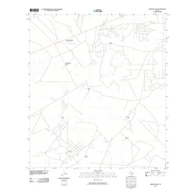
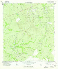
2010 Map of Sarnosa Hill
USGS Topo · Published 2010About this map
Lundell Oil Field and several neighboring petroleum operations define the industrial character of this Duval County landscape, where the energy economy is deeply integrated into large ranching tracts. The map illustrates a complex network of access roads and infrastructure supporting both oil extraction and cattle ranching, most notably at the Duval Ranch. Water management is critical in this brush country environment, as evidenced by the Duval County Ranch Colmena Tank Dam and Colmena Tank, which capture drainage from Colmena Creek. Topographically, the area is punctuated by modest elevations like Sarnosa Hill and Cedro Hill, providing landmarks across the varied terrain. The presence of the Duval County Ranch Company Airport further highlights the scale of these private holdings during the early 21st century.
Find a feature on this map
16 named features on this map. Tap any name to fly to it.
Don’t see what you’re looking for? This feature index may not catch every label — zoom into the map to look around manually.
Map Details
Editions of this 2010 Sarnosa Hill Map
This is the sole edition of this map. No revisions or reprints were ever made.
Other maps of this area

1956 · Freer
USGS Topo · 1:62,500

1956 · Las Mujeres
USGS Topo · 1:62,500

1956 · Laredo
USGS Topo · 1:250,000

1968 · Mills Bennett
USGS Topo · 1:24,000

1968 · Parrilla Creek NW
USGS Topo · 1:24,000

1968 · Parrilla Creek NE
USGS Topo · 1:24,000
1971 · Freer North
USGS Topo · 1:24,000
1971 · Freer South
USGS Topo · 1:24,000
1971 · Freer NW
USGS Topo · 1:24,000
1971 · Sarnosa Hill
USGS Topo · 1:24,000