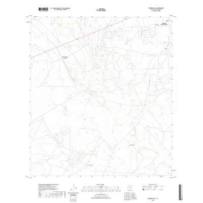
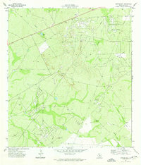
2019 Map of Sarnosa Hill
USGS Topo · Published 2019About this map
Magnolia Road Colonia and the outskirts of Freer anchor the northeast corner of this South Texas landscape, where the ranching heritage of Duval County is evident in the sprawling land divisions. The terrain is defined by prominent rises like Sarnosa Hill and Cedro Hill, which overlook a network of ephemeral drainage systems including Colmena Cr, Soledad Cr, and the northern and southern forks of Animas Cr. A notable aviation landmark, the Duval County Ranch Company Airport, sits central to the upper half of the quadrangle, reflecting the importance of private air travel in managing large-scale ranching operations. The presence of Colmena Tank highlights the critical role of water management in this arid environment, providing a focal point for livestock and local ecology.
Find a feature on this map
14 named features on this map. Tap any name to fly to it.
Don’t see what you’re looking for? This feature index may not catch every label — zoom into the map to look around manually.
Map Details
Editions of this 2019 Sarnosa Hill Map
This is the sole edition of this map. No revisions or reprints were ever made.
Other maps of this area

1956 · Freer
USGS Topo · 1:62,500

1956 · Las Mujeres
USGS Topo · 1:62,500

1956 · Laredo
USGS Topo · 1:250,000

1968 · Mills Bennett
USGS Topo · 1:24,000

1968 · Parrilla Creek NW
USGS Topo · 1:24,000

1968 · Parrilla Creek NE
USGS Topo · 1:24,000
1971 · Freer North
USGS Topo · 1:24,000
1971 · Freer South
USGS Topo · 1:24,000
1971 · Freer NW
USGS Topo · 1:24,000
1971 · Sarnosa Hill
USGS Topo · 1:24,000