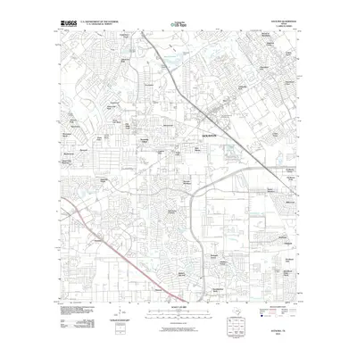
2010 Map of Satsuma
USGS Topo · Published 2010About this map
Satsuma and Jersey Village anchor this corner of Harris County, showing the suburban expansion and industrial infrastructure Northwest of Houston in the early 21st century. The map reveals a landscape defined by an intricate network of residential subdivisions like Canterbury Forest, Norchester, and Winchester Country, woven between natural watercourses such as Cypress Creek and Whiteoak Bayou. These bayous and gullies, including Pillot Gully and Faulkey Gully, serve as the primary drainage for the increasingly developed terrain.
Find a feature on this map
97 named features on this map. Tap any name to fly to it.
Don’t see what you’re looking for? This feature index may not catch every label — zoom into the map to look around manually.
Map Details
Editions of this 2010 Satsuma Map
This is the sole edition of this map. No revisions or reprints were ever made.
Other maps of this area

1915 · Houston Heights
USGS Topo · 1:24,000

1915 · Cypress
USGS Topo · 1:24,000

1915 · Addicks
USGS Topo · 1:24,000

1915 · Hillendahl
USGS Topo · 1:24,000

1916 · Rose Hill
USGS Topo · 1:24,000

1916 · Aldine
USGS Topo · 1:24,000

1916 · Louetta
USGS Topo · 1:24,000

1916 · Satsuma
USGS Topo · 1:24,000

1916 · Spring
USGS Topo · 1:24,000

1918 · Cypress
USGS Topo · 1:31,680