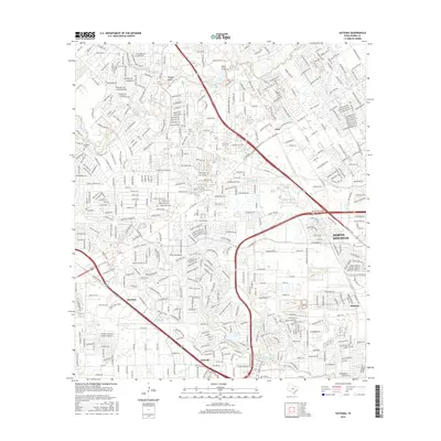
2016 Map of Satsuma
USGS Topo · Published 2016About this map
The suburban reaches of northwest Harris County are intricately detailed in this 2016 survey, where the residential expansion of North Houston meets the historical corridors of the Satsuma and Melendy areas. The landscape is defined by its complex drainage network, featuring the winding paths of Whiteoak Bayou and Greens Bayou, alongside notable local water bodies like Jersey Lake and Marshall Lake. This survey illustrates the dense layering of late-twentieth-century residential development over an older rural framework, where sites like Perry Cem and Dowdell Cem remain preserved amidst modern subdivisions. For genealogists and local historians, the map offers a precise view of naming conventions in neighborhoods spanning from Deco to Hudson, providing a clear record of the area's infrastructure and land use just prior to recent years of continued growth.
Find a feature on this map
173 named features on this map. Tap any name to fly to it.
Don’t see what you’re looking for? This feature index may not catch every label — zoom into the map to look around manually.
Map Details
Editions of this 2016 Satsuma Map
This is the sole edition of this map. No revisions or reprints were ever made.
Other maps of this area

1915 · Houston Heights
USGS Topo · 1:24,000

1915 · Cypress
USGS Topo · 1:24,000

1915 · Addicks
USGS Topo · 1:24,000

1915 · Hillendahl
USGS Topo · 1:24,000

1916 · Rose Hill
USGS Topo · 1:24,000

1916 · Aldine
USGS Topo · 1:24,000

1916 · Louetta
USGS Topo · 1:24,000

1916 · Satsuma
USGS Topo · 1:24,000

1916 · Spring
USGS Topo · 1:24,000

1918 · Cypress
USGS Topo · 1:31,680