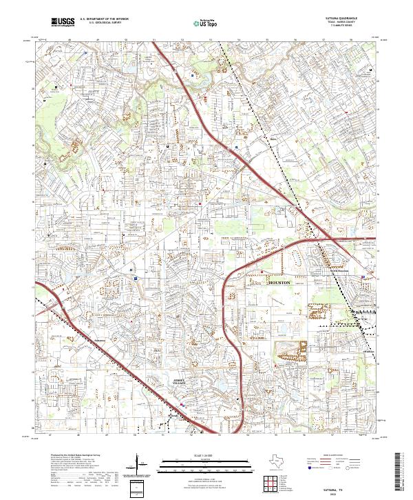
2022 Map of Satsuma
USGS Topo · Published 2022About this map
Jersey Village sits at the heart of this urban-industrial landscape northwest of Houston, where modern suburban development intersects with established transportation corridors and natural drainage systems. The map details the dense residential street networks of Satsuma and North Houston, as well as the industrial developments near Deco and Hudson. The area is bisected by the Hwy 290 Access Rd and Hwy 249 Access Rd, which serve as the primary arteries through a terrain defined by waterways like Cypress Creek, Whiteoak Bayou, and Faulkey Gully. For local historians and genealogists, the map preserves the location of small, family-associated sites such as Christen Family Cem and Molts Cem, alongside modern landmarks like Lone Star College University Park.
Find a feature on this map
23 named features on this map. Tap any name to fly to it.
Don’t see what you’re looking for? This feature index may not catch every label — zoom into the map to look around manually.
Map Details
Editions of this 2022 Satsuma Map
This is the sole edition of this map. No revisions or reprints were ever made.
Other maps of this area

1915 · Houston Heights
USGS Topo · 1:24,000

1915 · Cypress
USGS Topo · 1:24,000

1915 · Addicks
USGS Topo · 1:24,000

1915 · Hillendahl
USGS Topo · 1:24,000

1916 · Rose Hill
USGS Topo · 1:24,000

1916 · Aldine
USGS Topo · 1:24,000

1916 · Louetta
USGS Topo · 1:24,000

1916 · Satsuma
USGS Topo · 1:24,000

1916 · Spring
USGS Topo · 1:24,000

1918 · Cypress
USGS Topo · 1:31,680