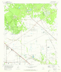
1970 Map of Satsuma
USGS Topo · Published 1973About this map
Jersey Village and the surrounding Harris County prairie are captured here in a state of mid-century transition, where established rural sites meet the expanding suburban footprint. The landscape is defined by the winding course of Cypress Creek and Greens Bayou, with legacy landmarks like Perry Cem and Dowdell Cem providing critical data points for genealogists. The influence of regional transit is clear, from the Southern Pacific RR corridors to the developing road network including Jackrabbit Road and Grant Road.
Find a feature on this map
71 named features on this map. Tap any name to fly to it.
Don’t see what you’re looking for? This feature index may not catch every label — zoom into the map to look around manually.
Map Details
Editions of this 1970 Satsuma Map
This is the sole edition of this map. No revisions or reprints were ever made.
Other maps of this area

1915 · Houston Heights
USGS Topo · 1:24,000

1915 · Cypress
USGS Topo · 1:24,000

1915 · Addicks
USGS Topo · 1:24,000

1915 · Hillendahl
USGS Topo · 1:24,000

1916 · Rose Hill
USGS Topo · 1:24,000

1916 · Aldine
USGS Topo · 1:24,000

1916 · Louetta
USGS Topo · 1:24,000

1916 · Satsuma
USGS Topo · 1:24,000

1916 · Spring
USGS Topo · 1:24,000

1918 · Cypress
USGS Topo · 1:31,680