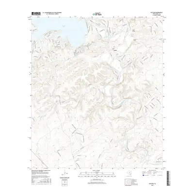
2016 Map of Sattler
USGS Topo · Published 2016About this map
The Guadalupe River carves a winding path through the limestone hills of Comal County, anchoring the settlement of Sattler and shaping a landscape defined by dramatic water features. This modern topographical record shows the river just downstream of Canyon Lake, where it creates significant landmarks like Horseshoe Falls and Slumber Falls. The terrain is characterized by deep ravines such as Heiser Hollow and Cordova Hollow, alongside a complex drainage network including Mountain Cr, Turkey Cr, and Deep Cr.
Find a feature on this map
131 named features on this map. Tap any name to fly to it.
Don’t see what you’re looking for? This feature index may not catch every label — zoom into the map to look around manually.
Map Details
Editions of this 2016 Sattler Map
This is the sole edition of this map. No revisions or reprints were ever made.
Other maps of this area

1920 · Smithsons Valley
USGS Topo · 1:62,500

1925 · New Braunfels No 1
USGS Topo · 1:48,000

1925 · Hunter No 3
USGS Topo · 1:48,000

1925 · Smithson Valley No. 1
USGS Topo · 1:48,000

1927 · New Braunfels
USGS Topo · 1:62,500

1927 · Smithson Valley
USGS Topo · 1:62,500

1929 · Hunter
USGS Topo · 1:62,500

1929 · Smithson Valley
USGS Topo · 1:62,500

1940 · Smithson Valley
USGS Topo · 1:62,500

1953 · Bat Cave
USGS Topo · 1:24,000