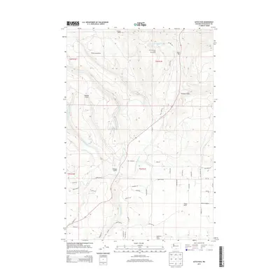
2013 Map of Satus Pass
USGS Topo · Published 2013About this map
Satus Pass serves as a central geographic corridor through the Simcoe Mountains in this high-altitude portion of Klickitat County. The terrain is defined by the convergence of the E Prong Little Klickitat River and the W Prong Little Klickitat River, which unite to form the Little Klickitat River. Land use in the early 21st century reflects a mix of recreation and aviation, most notably at the Brooks Memorial State Park Ski Area and the Aerostone Ranch Airport. Deep incisions like Highland Canyon and Idlewood Canyon break the upland plateaus, while Munson Prairie provides a rare stretch of level ground among the ridges. Numerous local roads such as Box Canyon Rd and Jenkins Creek Rd branch off US Highway 97, tracing the complex drainage patterns of Jenkins Cr and Butler Cr.
Find a feature on this map
52 named features on this map. Tap any name to fly to it.
Don’t see what you’re looking for? This feature index may not catch every label — zoom into the map to look around manually.
Map Details
Editions of this 2013 Satus Pass Map
This is the sole edition of this map. No revisions or reprints were ever made.
Other maps of this area

1937 · White Swan
USGS Topo · 1:125,000

1950 · Yakima
USGS Topo · 1:250,000

1953 · The Dalles
USGS Topo · 1:250,000

1956 · The Dalles
USGS Topo · 1:250,000

1957 · The Dalles
USGS Topo · 1:250,000

1957 · Goldendale
USGS Topo · 1:62,500

1957 · Satus Pass
USGS Topo · 1:62,500

1958 · Yakima
USGS Topo · 1:250,000

1961 · Yakima
USGS Topo · 1:250,000
1965 · Kusshi Creek
USGS Topo · 1:24,000