
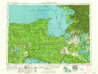
1956 Map of Sault Sainte Marie
USGS Topo · Published 1964About this map
St Marys River serves as the focal point of this Eastern United States survey, connecting the commerce of the Upper Peninsula with the Great Lakes shipping lanes. The map captures the mid-century landscape of the Eastern Upper Peninsula, where the Soo Line railroad cuts through the heavy timberlands of the Hiawatha National Forest and Mackinac State Forest. Small lakeside settlements like Shelldrake and Emerson appear along the shores of Whitefish Bay, while the international border between Michigan and Ontario splits the waters near Sault Sainte Marie. Inland, the survey reveals a network of rivers like the Tahquamenon and Manistique, indicating the importance of these waterways to the local economy and the established Bay Mills Indian Reservation.
Find a feature on this map
112 named features on this map. Tap any name to fly to it.
Don’t see what you’re looking for? This feature index may not catch every label — zoom into the map to look around manually.
Map Details
Editions of this 1956 Sault Sainte Marie Map
2 editions found
Other maps of this area

1913 · Sault Sainte Marie
USGS Topo · 1:62,500

1919 · Neebish
USGS Topo · 1:62,500

1931 · St Ignace NW
USGS Topo · 1:31,680

1931 · Seney SW
USGS Topo · 1:31,680

1931 · Seney NW
USGS Topo · 1:31,680

1931 · Pickford SE
USGS Topo · 1:31,680

1931 · Epoufette SE
USGS Topo · 1:31,680

1931 · Manistique River NE
USGS Topo · 1:31,680

1931 · Driggs Lake NE
USGS Topo · 1:31,680

1931 · Gould City NE
USGS Topo · 1:31,680